
Surrounded by jagged peaks and glaciers, Mt Alfred looks like a tiddler – an easy hiking option, you’d think. He’s not, exactly. He’s a bad boy of a mountain (1300m) surrounded by serious competition. This is the start of Mount Apsiring National Park, home to New Zealand’s highest mountains.
I truly realised this as I reached the last few sets of rocks before the top. It had taken me about 2 hours to get this point. I slung my camera onto some rocks above, took good hold of an edge and hauled myself up, foot to hand, wind buffeting my face.
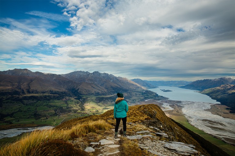
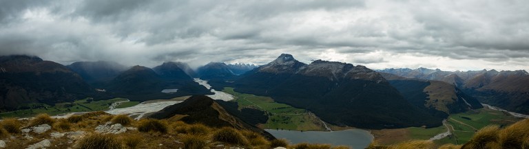
What a view!
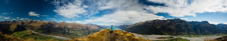
It’s a textbook finish – step up and be greeted by 360 degrees of amazing views. It’s so incredibly satisfying. Then you can follow Mt Alfred’s spine in both directions to get your fill of mountains, lakes, glaciers, forests… and so on.

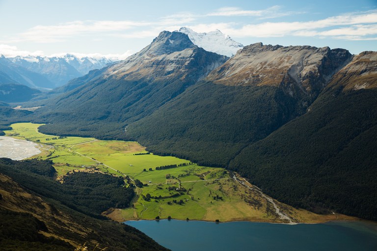
It’s worth walking in the direction away from the lake towards the mountains, where you’ll overlook stunning Lord of the Rings territory. Countless other films have taken advantage of this area, too. One of the roads that winds below you leads to Paradise. Yes, that’s a place in New Zealand, and you can see it all from the top of Mt Alfred.

The Details
The DOC say this track takes 6 – 8 hours, but I think most people take 5-6. I took 6, with 1.5 hours on top taking pics.
They say it’s an advanced hike, and I can kind of see why. It’s not as straight-forward as the great walks – some bits are steep and muddy, and after the tree line Mt Alfred gets quite scrambly. But don’t be too put off by this last 15-20 minutes or so. Looking up from the beginning of this section (or looking back down again from the top) looks pretty daunting, however it’s perfectly do-able with some concentration and a fairly good set of legs.

There are a few parts where you have to kind of climb, so make sure you can have your hands free. There is a loosely-formed track to follow up this last section, with orange markers to lead you. They’re pretty easy to spot in clear weather, though I’d imagine this would be a totally different story in bad weather. You’d have to pay me good money to do it in bad weather.

How to find it
The hike’s starting point is really easy to find. Firstly you can’t really miss Mt Alfred – he’s the “little” one in the valley between all the really high ones and faces the beginning of Lake Wakatipu. The track begins on the left hand side of the mountain if you’re coming from the direction of Queenstown/Glenorchy. The road hugs the edge of the mountain, and the track begins at a little carpark. It’s not signposted here but it’s the only car park beside the road. There are some steps that take you over a fence, and away you go. Enjoy this flat bit of land – it’s last you’ll be walking on until you reach the top!
There’s no public transportation that takes you directly there, but it’s such a small friendly area that you can easily hitch a ride to get there and back. I got offered a lift home without even asking :)


Absolutely amazing! Best, Nataly
Thanks!